|
 Рейтинг:
 |
|
|
|
Слова для поиска: | Sahara, desert, deserts, Africa, satellite, image, images, place, places, nature, natures, travel, travels, tour, tours, trip, trips, NASA, World, Wind, great, world, worlds, second, largest, Antarctica, area, areas, 9400000, square, kilometers, kilometer, length, 4800, km, width, 1800, Red, Sea, seas, Mediterranean, coasts, coast, Atlantic, Ocean, oceans, countries, country, Northern, Algeria, Chad, Egypt, Eritrea, Libya, Mali, Mauritania, Morocco, Niger, Sudan, Tunisia, disputed, territory, territories, Western |
| |
Дата: | 29.07.2011 13:32 |
| |
Просмотров: | 13570 |
 Описание:
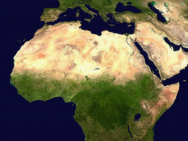
A satellite image by NASA World Wind of the Sahara desert in Africa (the Great Desert), the world's second largest desert after Antarctica, with area over 9,400,000 square kilometers (length 4,800 km and width 1,800 km). The desert Sahara borders with Red Sea, the Mediterranean coasts, the Atlantic Ocean and covers most countries of Northern Africa, as Algeria, Chad, Egypt, Eritrea, Libya, Mali, Mauritania, Morocco, Niger, Sudan, Tunisia and the disputed territory of Western Sahara.
 |

|